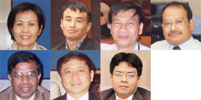
Interview at 4th Sentinel-Asia Joint Project Team Meeting

⑴ Ms. Monemany NHOYBOUAKONG
SCOSA Chairperson, ASEAN Subcommittee on Space Technology and Applications (ASEAN-SCOSA)
Q1.
Could you introduce the space related activities in the framework of SCOSA?
A1.
The main objectives of SCOSA are to formulate a framework for enhancing collaboration in the field of space technology and its applications, and to implement programs and projects towards operating those technologies for sustainable development for the ASEAN region. SCOSA has the following three themes of the space technology services for the five years from 2007 to 2011.
- Geoinformatics that is composed of Remote Sensing, the Geographic Information System (GIS) and the Global Positioning System (GPS), including the use of meteorological data for non-meteorological applications such as detecting forest fires, and monitoring haze and floods;
- Communication and satellite technology applications for managing environmental and natural resources and conducting spatial planning, as well as tele-education and tele-medicine;
- Development and transfer of technologies relating to micro and small satellites, sensors and ground facilities.
The SCOSA is trying to disseminate the remote sensing technology applications in Asian countries and implement projects with our dialogue partners and other donors. Right now we do not have a specific, common policy for space technology and utilization, thus to establish a common policy in the ASEAN region is an important issue for us.
Q2.
What expectations do you have for APRSAF?
A2.
We think APRSAF is a very valuable forum open to all entities involved in the fields of space technology and science as well as the applications of those fields, which enables a variety of entities to participate in APRSAF and discuss current space-related issues, and enables cooperation among countries mainly in the Asia-Pacific region.
We expect APRSAF will become a forum for its participants to work on establishing a common policy for space technology and utilization, and hopefully that policy will be built within three to five years.

⑵ Mr. Jigme Choda Jamtsho
Computer Programmer/Data Manager, Ministry of Home & Cultural Affairs, Kingdom of Bhutan
Q1.
Could you tell us about the present environmental issues in your country?
A1.
There is an increasing fear that snow and ice, which are rapidly melting because of the global warming, could cause glacial lakes to discharge in Bhutan, and the past few years there have been frequent landslides caused by monsoons.
Q2.
Are there any countermeasures you can take against those disasters?
A2.
For countermeasures against disasters, we have a plan to make hazard maps using satellite data. As the matter of fact, we are facing to problems with our communication networks; therefore we need to improve our infrastructure to communicate via the Internet for example. However it is difficult to obtain enough funds for this because the costs involved are huge.
We also need to train people in the latest technology for data processing and analysis and disaster management.
Q3.
What are your expectations for APRSAF?
A3.
We would greatly appreciate it if APRSAF framework could assist us to solve the problems I have just mentioned.
We think that APRSAF is a very effective forum where we can obtain a lot of useful information from various countries.

⑶ Mr. Le Van DIEM
Programme Coordinator, Information and Knowledge Management Programme, Mekong River Commission (MRC)
Q1.
Please explain the current activities of MRC for disaster management.
A1.
MRC is a member of Sentinel Asia, and now we are planning to provide disaster related information, especially about flooding and reports on the Mekong Basin, to Sentinel Asia including emergency response to quickly share disaster information.
Q2.
Are there any projects going on right now?
A2.
We are now tackling with environmental problems with the Mekong River such as the river's water quality and quantity. We need topographic base maps along the river from the upstream to the downstream area, to monitor its conditions.
We think earth observation data from satellites such as ALOS would be suitable for making this kind of map because of its cost and availability.
Q3.
What is your impression of APRSAF?
A3.
APRSAF is a forum where useful information from various countries can be shared, and we think that Sentinel Asia in particular helps Asian nations for disaster management.
⑷ Mr. N M Joshi
Senior Division Engineer, Department of Water Induced Disaster Prevention, Nepal
Q1.
How does your organization deal with natural disasters?
A1.
There is a fear that glacier lakes will discharge because of global warming and landslides have recently been occurring frequently in Nepal.
We plan to make base maps using satellite data for the disaster management system.
In particular, we have a plan to use SAR (Synthetic Aperture Radar) data which can transmit our observations day and night regardless of the weather conditions.
Q2.
What are your expectations for APRSAF?
A2.
Although we have a certain amount of knowledge about optical sensors, our knowledge and experiences about using SAR data is limited. To implement disaster management, there are needs in our country to have both satellite-based and ground-based information.
Under these circumstances, it would be nice if the framework of APRSAF could provide opportunities for capacity building and training for people in the use of satellite data, introduce data processing and analysis techniques and improve our infrastructures
Sharing information about the current situation and activities for disasters is very important for the development of space technology in Asian countries.
We hope that APRSAF will continue to have an annual meeting and its related workshops and meetings.
⑸ Mr. K.W.N.D. Karunaratne
Senior Deputy Survey General, Survey Department, Ministry of Land and Land Development, Democratic Socialist Republic of Sri Lanka
Q1.
How does your organization use satellite data?
A1.
There are some areas in Sri Lanka where we cannot conduct surveillance activities to map the area. We therefore think that applying satellite data for mapping is one of the good solutions. However, we are now facing several problems in obtaining this data including problems with its cost, and the processing and analyzing systems that are required.
Q2.
What are your expectations for APRSAF?
A2.
We would like to propose that APRSAF establishes a satellite data receiving center in developing countries and satellite data should be provided to the users in those countries at either cheaper rates or free of charge.
Another proposal is that APRSAF establishes an information secretariat to keep all records of the satellite data and makes it available to countries in the region, and sets up a training center to train people or exchange technology for data processing and analysis in APRSAF countries. In addition, I think that financial support from developed countries to less privileged countries by means of loans or grants is necessary to increase the users of satellite data and to ensure there is high demand for that data.
Finally, it would be better if we could have an emergency unit as part of APRSAF that can act promptly after a disaster occurs. We find it very useful to exchange opinions, share information, and have a common awareness of problems in APRSAF's sessions.

⑹ Dr. Surachai Ratanasermpong
Deputy Director, Geo-Informatics and Space Technology Development Agency (GISTDA), Thailand
Q1.
Please introduce the activities of GISTDA.
A1.
We have been addressing an efficient and effective way to manage land and agriculture because every year there are disasters such as floods caused by typhoons, and forest fires.
GISTDA will launch the first Thai Earth Observation Satellite, THEOS-1, in January 2008, which will monitor the land and help us work on disaster mitigation and management. We have been providing LANDSAT data to Sentinel Asia and will also provide the data from THEOS-1. In addition, we will respond to any emergency situations detected by THEOS-1.
Q2.
Does GISTDA have been offering any types of cooperative activities to the Asia-Pacific countries?
A2.
GISTDA has providing training in the use of satellite data not only in Thailand but also overseas. We are now using a caravan to train local researchers in Thailand.
However there is a problem in communicating with other Asian countries; the network system in some countries in Asia is not always so good. Communication satellites such as the Wideband InterNetworking engineering test and Demonstration Satellite (WINDS) will become a very important way to communicate in Asia. We expect that JAXA will promote communication infrastructure on the ground such as equipment for receiving and processing data.
⑺ Dr. Pham Anh Tuan
Vice Director, Space Technology Institute (STI), Vietnamese Academy of Science and Technology (VAST), Vietnam
Q1.
What natural disasters does your organization deal with?
A1.
Vietnam frequently suffers from flood damage caused by typhoons. As a matter of fact, we suffered flood damage five times in November 2007. In addition, Vietnam's coastal area has oil pollution. We need to take some measures to mitigate natural disasters such as flooding and monitor the sea using satellites, with which we can conduct continuous monitoring and make observations over a wide area.
The Vietnamese Academy of Science and Technology (VAST) is responsible for the Earth Observation Small Satellite Project (VNREDSat-1), a project to monitor natural resources, the environment and disasters.
One of the VAST's projects, HOA LAC Space Center's project, aims to develop space science and technology. The center first conducted a survey, and then set up a project and asked for funding in 2007.
Q2.
What expectations does VAST have for APRSAF?
A2.
We hope that APRSAF will continue to work on permanent and specific projects for common issues such as natural disasters in Asia.
We think that APRSAF is a very valuable forum that works on common issues in Asian countries, as I have just mentioned.