LAPAN-TUBSAT Video Under Extensive Study For Land Use Applications
Users can directly use the video data from surveillance satellites for surveillance applications. However, users could also go further and use the video for other applications such as land use applications. For such applications, LAPAN is still under extensive study with regards to how to use LAPAN-TUBSAT video. Video frames have been stitched together to give an image of a wider area and also georeference the data.
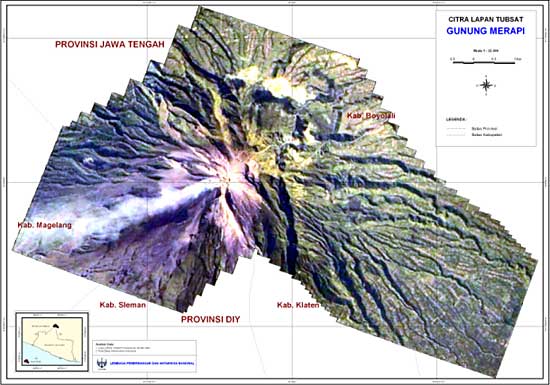
The image shown below is of Mount Merapi. It was stitched together from LAPAN-TUBSAT video frames taken while the satellite was in target-locking mode in that area on May 25, 2007. The stitched images can be used after they have undergone geometric corrections. Geometric correction is done using ground control points which are obtained from other reference images. Also shown is an image of Mount Merapi after that image underwent correction and contrast stretching. Geometric correction for this Mount Merapi image used 26 GCP and the average RMS error was 0.624, which is acceptable.
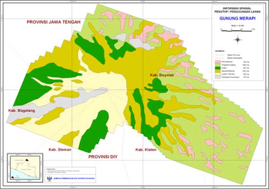
The image above was produced after a number of images were stitched together and after it underwent geometric correction and image enhancement. This image is interpreted using a landscape ecology approach and land use identification. Since the resolution of LAPAN-TUBSAT images is five meters, it is not so difficult to make visual identification based on logical connections between landforms and land cover, while also considering the colors, shapes, patterns, sizes and associations in the image. Below is final Mount Merapi land use map which can be used by Indonesian users. This approach is used to provide a complementary image in addition to common remote sensing image data.
LAPAN Website: http://www.lapan.go.id/