Main Projects and Pictures
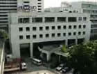
1. For activity of Geo-Informatics and Space Technology Development Agency,
Please visit http://www.gistda.or.th
2. Satellite Data and Processing
For more information,
please visit
http://www.gistda.or.th/Gistda/HtmlGistda/Html/HtmlTechnic/Html/SatDigSpec/EnDigSpec.html
| Reception | for more technical information,
please visit http://www.gistda.or.th/Gistda/HtmlGistda/Html/HtmlDataServices/EnIndex.html |
|---|---|
| Distribution | For products and services
on satellite data and catalog browser system, please visit
http://www.gistda.or.th/Gistda/HtmlGistda/Html/HtmlDataServices/EnIndex.html |
| Applications | Please see GIS Data Applications |
3. GIS Data
| Standardization | For GIS standardization, please visit http://www.gistda.or.th/Gistda/HtmlGistda/Html/HtmlGIS/Standard/Thmainstandard.html |
|---|---|
| Applications | GIS Data are widely-used in several areas. |
| Agriculture | The satellite data received can be applied in accordance with plantation , particularly in cash crops such as annual and quarter annual rice, palm oil, rubber, pineapple, cassava, sugar cane, maize and sun flower. Those data are pooled and classified for each type of cash crop. With these data, we can efficiency forecast and appraise the production, also to study and trace the coastal agriculture as well. |
| Forestry | The satellite data received can be applied in study the whole forestry area and surveillance the change, particularly in rain forest and fertile land or even deforestation. These data are pooled and employed as plan to protect and to resurrect the forestation. |
| Land using | The satellite data received can be applied as a method of using the land in most productive ways like production, serve human needs, |
| Geology | The satellite data received can be applied in studying and making cartography , rocks classification, other structure classifications and exploring minerals and petroleum. |
| Hydrology | The satellite data received can be applied in planning, controlling, preventing, curing, surveillancing and appraising the conversely effects from floods and water resource management as well. |
| Environment and natural disaster | The satellite data received can be applied in monitoring in both environment and natural disaster such as land slide, floods and forest fire. |
| Oceanography | The satellite data received can be applied like studying the sediment in the sea and coast, coastal fisheries and surface temperature and maritime as well |
| Urban planning | The satellite data
received can be applied in urban studying, provincial/regional/national
area studying and topography For more information on applications, please visit http://www.gistda.or.th/Gistda/HtmlGistda/Html/HtmlApplications/EnIndex.html |
 GISTDA |
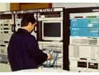
 Acquisition |
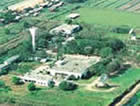
 Satellite Ground Station |
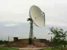
 Antenna |