Indonesian First Micro Remote Sensing Satellite Performs Well
The Indonesian first micro remote sensing satellite, LAPAN-TUBSAT, which was jointly developed by Indonesian Aerospace
Institute (LAPAN) and the Technical University of Berlin (TUB), launched into orbit at an altitude of approximately 630 km in January 2007,
is now performing well.

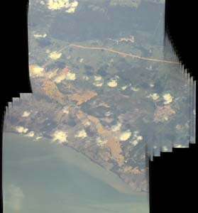
Fig1: East Java

Fig2: Madra

Fig3: Singapore Changi Airport
Mr. Abdul Rahman, the Head of Ground Segment Division of Aerospace Electronics Technology Center (AETC) of LAPAN gave the APRSAF details about the present status of LAPAN-TUBSAT including the ground segments.
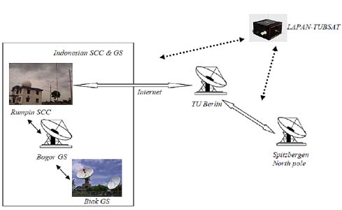
The Spacecraft Control Center (SCC) of LAPAN has been developed in Rumpin area of Indonesia for monitoring the status of the satellite and the LAPAN also has a plan to develop the ground station in Biak Island near New Guinea Island in order to cover the eastern side of Indonesia.
The satellite operators in the Rumpin SCC connected to the ground station in Spitzbergen of North Pole and the TU-Berline ground station can monitor all the LAPAN-TUBSAT passes and its conditions.

Fig4: Ground network of LAPAN-TUBSAT
About the further information, please refer to the following:
PAPER_ASC2007-WHASBI-LAPAN.pdf (application/pdf)
PAPER_ASC2007-WHASBI-LAPAN.pdf (application/pdf)