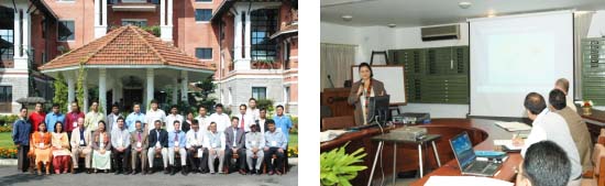
Workshop on Application of Satellite Rainfall Estimation in the Himalayan Region of the Hindu Kush, Nepal, October 1-5
Accurate rainfall estimates are required to minimize the effects of floods and droughts. The density of hydrometeorological stations in the Himalayas is not sufficient to accurately estimate the rainfall using a sparse network. Hence, using advanced remote sensing tools and techniques for satellite rainfall estimation (SRE) would provide reliable and timely data to supplement the gauge stations and fill in the data gaps to forecast floods with greater accuracy. A project called "Application of Satellite Rainfall Estimation in the Himalayan Region of the Hindu Kush" was initiated in June 2006, sponsored by the United States Agency for International Development's Office of U.S. Foreign Disaster Assistance (USAID/OFDA). As part of this project a documentation workshop was conducted by the International Center for Integrated Mountain Development (ICIMOD) from October 1 to 5, 2007. Technical experts from national hydrological and meteorological services from Bangladesh, Bhutan, China, India, Nepal, and Pakistan attended the five-day workshop. Technical experts from the National Oceanic and Atmospheric Administration (NOAA) and U.S. Geological Survey (USGS) provided technical expertise to the workshop.
The five-day workshop reviewed and discussed the work on SRE, particularly the validation of rainfall estimates and testing of the geospatial stream-flow model (GeoSFM) in pilot catchments. The workshop provided a further opportunity to strengthen the SRE capability of the hydrologists and meteorologists of the member countries and transfer NOAA/USGS technology. Based on their experience and lessons learnt from the project, the partners identified the strengths and weakness of the SRE technology and provided recommendations for further implementation of SRE on a regional and national scale. Building upon the outcome of this project and with the inputs from the partners, the activities for Phase II were discussed and planned. An action plan was agreed upon for completing the activities of the current phase and for preparing the proposal for the second phase.
Comment from Mr Sagar Ratna Bajracharya, the satellite hydrology officer of ICIMOD: The documentation workshop provided an opportunity to collate all the work that had been done on the satellite rainfall estimation project by partner countries (Bhutan, Bangladesh, China, India, Nepal and Pakistan) on a national and regional level. This was a working workshop where a lot of interaction occurred and which provided all partners with an opportunity to discuss their difficulties and clarify their doubts about the satellite rainfall estimates and products. In general it was found that the CPC RFE 2.0 underestimates (negative bias) the rain for most of the rain regimes during the monsoon period except for the Trans-Himalayan region (positive bias). It was also observed that the decadal sum of CPC and observed rain has a higher correlation when compared with daily data. The participants expressed their continued interest in the application of SRE (satellite rainfall estimation) in the region.