Interview with Indonesian National Institute of Aeronautics and Space (LAPAN)

June 3, 2008
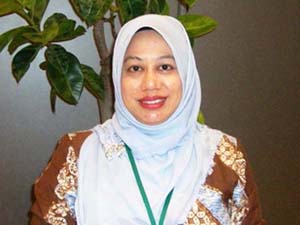
On June 3, 2008, APRSAF secretariat made an interview with Dr. Orbita Roswintiarti, Head of the Natural Resources and Environmental Monitoring Division, LAPAN.
Application of Satellite Data for the Environment and Disasters in Indonesia
Indonesia is very big country, therefore the utilization of the Earth Observation satellites is very effective for monitoring its environment. My responsibility right now is to provide the daily and monthly information related to conditions in the atmosphere, land and ocean. In the atmosphere, we monitor cloud movements and rainfall. On land, we are monitoring mostly floods, wildfires, and drought potentials. In the ocean, we are providing fishing ground forecasting. The data we use has a low spatial resolution but high temporal resolution, like NOAA, MODIS and Feng Yun.
Land cover and land cover change are also very important information in assessing disasters. Although we have already the national land cover map which was mainly made by Landsat, but to make it updated regularly is very challenging. To update it all at once will be very expensive, and some areas are always covered by cloud. The plan is to do it step by step. ALOS data is one of the options to be used, because it is not expensive. However, we still have to learn about the data as it is quite new.
Expectations for ALOS in the Area of Forest Monitoring
The usage of ALOS data in monitoring the regional wildfires on a daily basis is not applicable because of its infrequent revisiting period. But to build an understanding of land cover in one go would be very useful. We can see the land cover change every year from ALOS data.
Indonesia needs more radar data, because of our problem with cloud cover. Although the interpretation of radar imagery is not simple, some trainings and capacity-building programs within the ALOS pilot project have been conducted to process and analyze PALSAR ALOS data. Moreover, we also work together with the related institutions in some PALSAR ALOS applications. So in the future, we will be able to use radar data much more easily and we will also be able to educate people in the local area.
LAPAN's Contributions to Sentinel Asia
LAPAN has involved in Sentinel Asia since the very beginning. We are involved in the emergency observations and the Wildfire working group, and occasionally we get involved in the flood working group. The emergency observations are very beneficial. Once a disaster occurs, we could urgently ask for and receive the data when it is available. For example, we got ALOS data before and after the eruption of Mount Merapi in 2006. In the Wildfire working group, we participated in the validation campaign for fires in Central Kalimantan in 2006 and 2007. We are very active in the wildfire monitoring community through sharing experiences and knowledge.
Plan for the Successor to LAPAN-TUBSAT
LAPAN-TUBSAT is an experimental satellite. It is a micro satellite that weighs only 55 kg. The success of its launch has demonstrated our capability in building a micro satellite. We are now in the stage of LAPAN-A2 development. All the systems and some attachments will still be the same. There will still be video streaming but there will be some enhancements to its altitude stability. LAPAN-TUBSAT is collaboration with the Technical University of Berlin. Learning from that collaboration, LAPAN-A2 will be built by Indonesian engineers and scientists. We hope it will be launched in 2010.