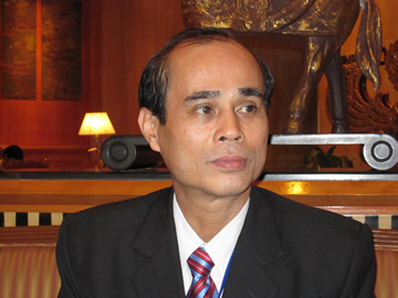
Interview with Assoc. Prof. Doan Minh Chung, PhD, Vice Director, Space Technology Institute (STI), Vietnam Academy of Science & Technology (VAST)

26 January, 2010, APRSAF-16
Our Space Technology Institute was established 3 years ago to implement the "Strategy for Space Research and Applications until 2020" approved by the Prime Minister. For long term development, we are going to build the Vietnam Space Center, modeled on Japan's Tsukuba Space Center. This Center is supported by Japan in terms of technical design, finance and specialists.
Presently, our activities are focused on 2 main trends. The first is satellite technology, and the second is remote sensing applications, the Geo-Informatic System (GIS) and the Global Navigation Satellite System (GNSS) for natural resources, the environment and disaster management. As you know, recently in Vietnam there have been many natural disasters like typhoons, flash floods, and soil erosion that killed many people and destroyed houses and villages.
Regarding business with APRSAF, we are currently participating in the Satellite Technology for Asia-Pacific Region Program (STAR program). For remote sensing, we are going to accomplish certain forest, forest fire and flood management projects within the scope of the Space Applications For Environment (SAFE) trend.
APRSAF is a regional forum, and cooperation between member countries is vital under the supervision and support of JAXA, MEXT and Japan. Among member countries, we have very similar living standards, climates, and proneness to disasters, hence we should share experiences with each other for disaster mitigation using space technology.
The key task for our Institute now is to enhance capacity building for human resource development, in order to master the small satellite technology and remote sensing applications for socioeconomic development. In this regard, we have received very kind cooperation and support from JAXA, Japan as well as regional countries, for which we thank you all very much.