Interview with Dr. Naomi Mathers, VSSEC, Australia
November 2010, at APRSAF-17, Melbourne

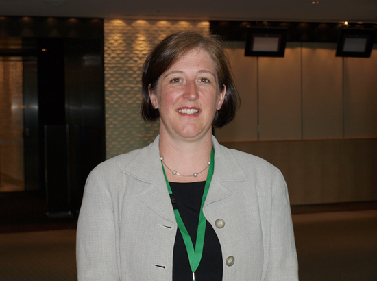
The APRSAF Secretariat conducted an interview with Dr. Naomi Mathers, Program Developer, Victorian Space Science Education Centre (VSSEC), Australia, on the occasion of APRSAF-17, in late November 2010, in Melbourne, Australia. Dr. Mathers has been involved in promoting space education and awareness in Australia.
Q: After a Japanese asteroid probe, Hayabusa, returning to the Earth, on the ground of Australia, in June 2010, Hayabusa has become very popular among the Japanese people. But there are still many issues regarding space education or public awareness in Japan. What about the situation in your country?
<Ma> We definitely have the same issues in Australia. The first issue is getting students to be interested in science, technology, engineering, and mathematics. At the Victorian Space Science Education Centre (VSSEC), we use the context of space to capture the students' interest. But, exciting the students is not enough; we then need to teach them basic science, mathematics, technology, and engineering. The students need to see where they will use their science and see that it's not as hard as it seems at first thought, and then hopefully we will get the scientists and engineers we need.
We've also found that issues like climate change and disaster monitoring are good for teaching science and mathematics. Students are very concerned about these topics, and there is a huge need for scientists and engineers to be trained in how to collect the data and how to use the data. It is also important that the students take this information home.
Q: Could you give us some examples of events you have held to reach out to your students?

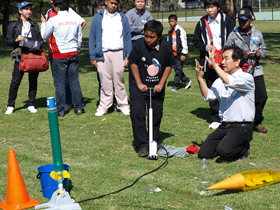
Learning how to launch a water rocket
<Ma> The water rocket event is an excellent example. The water rocket competition is one of the projects of the working group. We chose this project because all students can participate. It's not very difficult and hence no student is eliminated. And, the materials are cheap enough, so that any school or any student can participate in the event. It's very good for teaching science and mathematics. Newton's Laws, aerodynamics, and stability are all topics that can be discussed using the water rockets. And, it's a lot of fun.
Q: Teachers with experience in such projects would be needed to teach students.

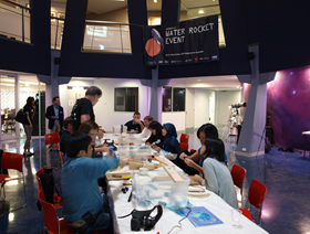
Instruction to teachers / water rocket event, VSSEC
<Ma> Yes, teacher training is very, very important. The teacher spends so much time with the students. If we have well-trained teachers, they can then share that knowledge with more students. So, we do teacher training.
The working group understands how important teacher training is, so each year, the working group has held an educator workshop. This year, we also added a day of educator training to the water rocket event. The more teachers can be exposed to experts and how to teach hands-on science the better. In these workshops, we can bring in experts to work with the teachers. We can conduct hands-on activities with the teachers to show them what they can then do with their students. They can take their experience back to their countries and their schools, and share all of that with other teachers.
Q: How about other projects, for example, CanSat?
<Ma> CanSat is one of our new projects. The working group is also talking about the CanSat activities. JAXA is very active in the CanSat activities. At VSSEC, we're working on CanSat with secondary school students for building the basic skills.
CanSat is an excellent way to teach electronics, satellite systems, and ground stations, and it also serves as a good context for talking about the use of satellite data for remote sensing, weather, and climate change. The students need to understand that satellites collect the data, but then someone has to process and analyze the data.
Q: What kinds of materials do you use to teach about climate change or natural hazards?
<Ma> Remote sensing images are excellent for teaching students about climate change. We try to use remote sensing images of Australia because the students will recognize them. If we're talking about Australia, we would perhaps be talking about a tropical cyclone in Western Australia or the bush fires that happen each year. So, these are natural disasters that our students are familiar with. We can show them how satellites can observe those hazards, and we can show them the importance of the ground data.
Using real data is important. So, we work with our Bureau of Meteorology, Geoscience Australia, and CSIRO (Commonwealth Scientific and Industrial Research Organisation) to access real data that we then include in curriculum materials that the teachers are comfortable with. They need instructions on how to analyze the data, because that's not their specialty. So, if we can put together curriculum materials that the teachers understand, they can then use those images or that data in the classroom to teach their students.
<Secretariat> Thank you very much.